Shrink swell subsidence – new dataset to help plan and prevent future risks
Shrink swell subsidence is by far the largest cause of natural subsidence insurance claims in the UK. Hot summers can see a surge in claims, with 10,000 claims for £64m recorded in the summer of 20181.
Given that most policies have an excess of around £1,000 for subsidence claims, the expense and inconvenience involved in dealing with subsidence issues are considerable, even before you factor in additional complications such as future insurance availability and resale value.
Traditionally conveyancing reports have been able to give you an indication of how prone certain types of ground are to subsidence, but have not been able to take account of other factors which can make a property more or less prone to actually subsiding. As a result, large swathes of the south east, for example, are shown to have a high potential for subsidence, but only a fraction of those will ever experience significant issues. Even a full physical survey can only identify where subsidence has taken place, rather than where it is more likely to happen in the future.
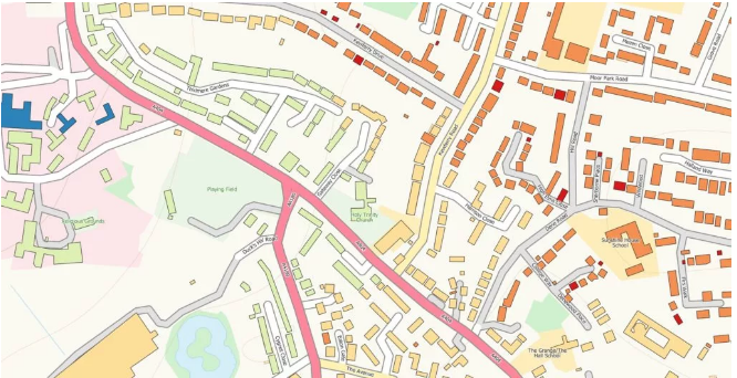
However, the British Geological Survey (BGS) have just launched an exciting new dataset which helps to further explore the relationship between properties, trees and the ground to give a much more detailed assessment of whether the property is at elevated risk of shrink swell subsidence.

New dataset showing variation of potential shrink well subsidence risks between houses
It’s not just the ground underneath your house – other factors which can influence whether a property is more likely to be prone to subsidence include:
- Distance to trees and their zones of influence
Many subsidence insurance claims are linked to damage caused by trees. Damage may occur as tree roots take up water from the soil, causing the ground to dry out and shrink causing uneven settlement. This occurs predominantly during the spring and summer months. Areas with many older houses and old-style shallow foundations can be seriously affected.
- Age of property
Changes in foundation design and building regulations mean that the age of a property can give an indication of foundation depths, which can impact the building’s ability to withstand ground movement.
- Drainage
In 1950 there was a change to building practices to use plastic rather than clay pipes. Clay pipes are more likely to crack as a result of ground movement, and the resulting leakages can exacerbate existing issues.
- Building type
Different types of building (e.g. bungalows, terraced property) have an influence on the extent of property damage if ground movement does occur. For example a terraced property may be better supported by buildings on either side than a detached property.
- Number of storeys
An increase in the number of storeys to a property increases the weight present above ground, and can therefore cause a property to be more significantly impacted by ground movement.
At the time of writing this blog, this data (known as the Property Subsidence Assessment or PSA) will only be available through Groundsure’s GeoRisk suite of reports (which launch on the 7th September 2020), and gives what we believe to be the most accurate and detailed assessment of actual risk to a property through shrink swell subsidence.
Groundsure’s new mining and ground stability reports, GeoRisk and GeoRisk + provide an in-depth understanding of natural and man-made ground risks to property. GeoRisk delivers expert insight and interpretation from the experts at Groundsure and Mining Searches UK. To find out more about these report, visit our website.
Reference:
Kindly shared by Groundsure


