


Groundsure: The importance of accurate coastal erosion data
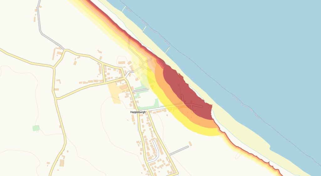
Groundsure GeoRisk reports utilise and visualise the latest National Coastal Erosion Risk Mapping (NCERM) from the Environment Agency and National Resources Wales to show exactly which areas will be at risk in both the scenario where local coastal defences are funded and maintained and additionally if defences were not present, or unfunded and abandoned (a scenario known as No Active Intervention).
Even assuming that government spending on coastal defences is maintained in perpetuity, we still see the likelihood of around 750 properties being lost to the sea in the short term (the next 20 years), a further 2,000 properties in the medium term (20-50 years), and an additional 5,700 in the long term (50 years+). If investment isn’t maintained through lack of available funds or political will, then these figures could rise to over 80,000 properties disappearing in the long term.
For each section of coastline we also provide links to the Shoreline Management Plans (SMPs) for the area, to give the full picture of the intended activity in the area, and to enable people to explore further.
There are four different scenarios for managing coastal erosion:
- No active intervention – this means that no new defences will be constructed and no maintenance of existing defences (if present) will be undertaken
- Hold the line – current defences will be maintained
- Managed realignment – this involves allowing the shoreline to move to an agreed position, and may involve some controlled erosion and loss of land
- Advance the line – this involves new defences planned to extend the land area out to sea. Unsurprisingly this is a very rare activity, and at present is planned in only one small area of Essex for a few hundred metres.
All of this data is available in the new GeoRisk reports and we are proud to produce the first to market search report to include this dataset and level of analysis – to find out more about GeoRisk – click here.
Kindly shared by Groundsure


