


Why ordnance sites are often not on the Ordnance Survey
Ironically one land use which has often been absent from Ordnance Survey maps is the location of ordnance and military related sites.
The OS started its life as an aid to military planning during the Jacobite Rising in 1745, and later developed in response to the French Revolution, but the potential usefulness of maps showing the location of military land is exactly the same reason that such uses have been treated with the highest sensitivity when compiling OS map editions.
Installations that have usually been treated as ‘secret’ include military airfields (prior to 1958), armament depots, explosives works, Government emergency oil depots, Government nuclear research or nuclear armament premises. As a general rule of thumb, if these installations were built for the specific military purpose, the site would be shown on an OS map as it was prior to the installation being built (show example), or else only water features, ‘continuous topographical features which cross the installation e.g. electricity transmission lines, railways, canals, public ways’, antiquities, boundaries and contours are shown.
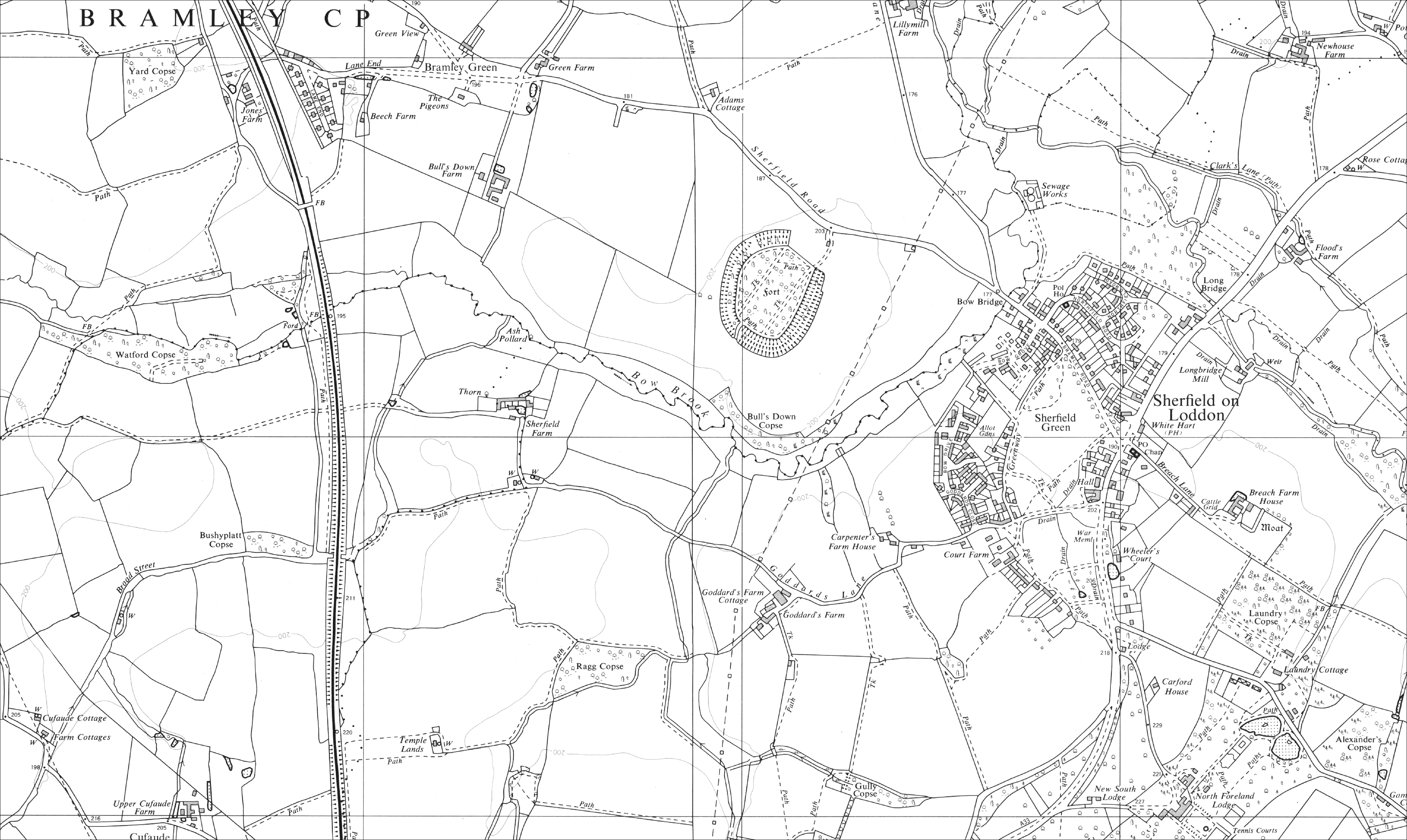
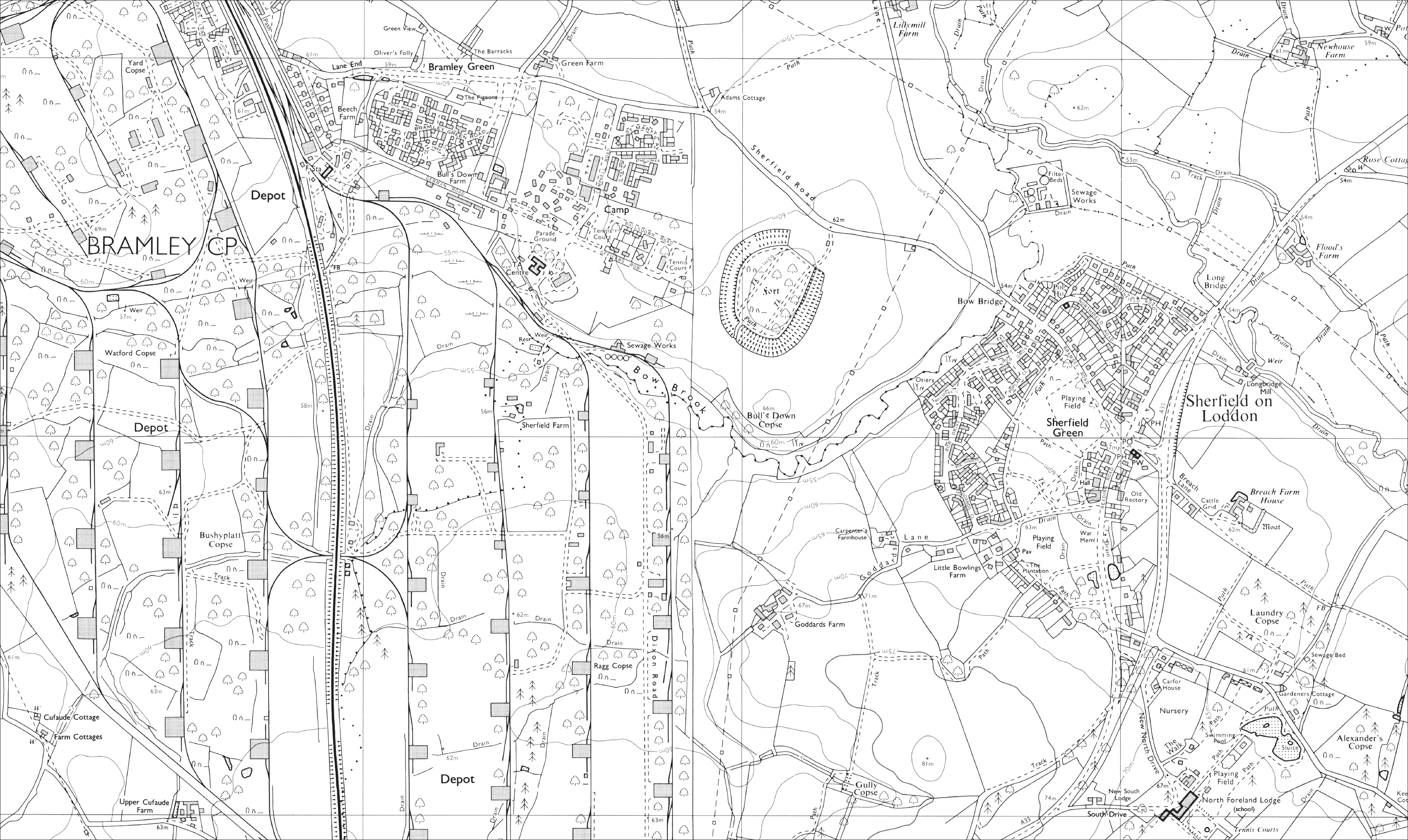
The development of Bramley Ordnance Depot in Hampshire illustrates this practice quite clearly:
Bramley Ordnance Dept – operational between 1917 and 1987
OS 1:10,000 scale 1969
OS 1:10,000 scale 1990
In 1927, Prime Minister Stanley Baldwin asserted that “No work of defence shall appear on any map on sale to the general public…No blank space shall appear, but the natural physical features of the country shall continue to appear”. Some of these efforts were more convincing than others however…
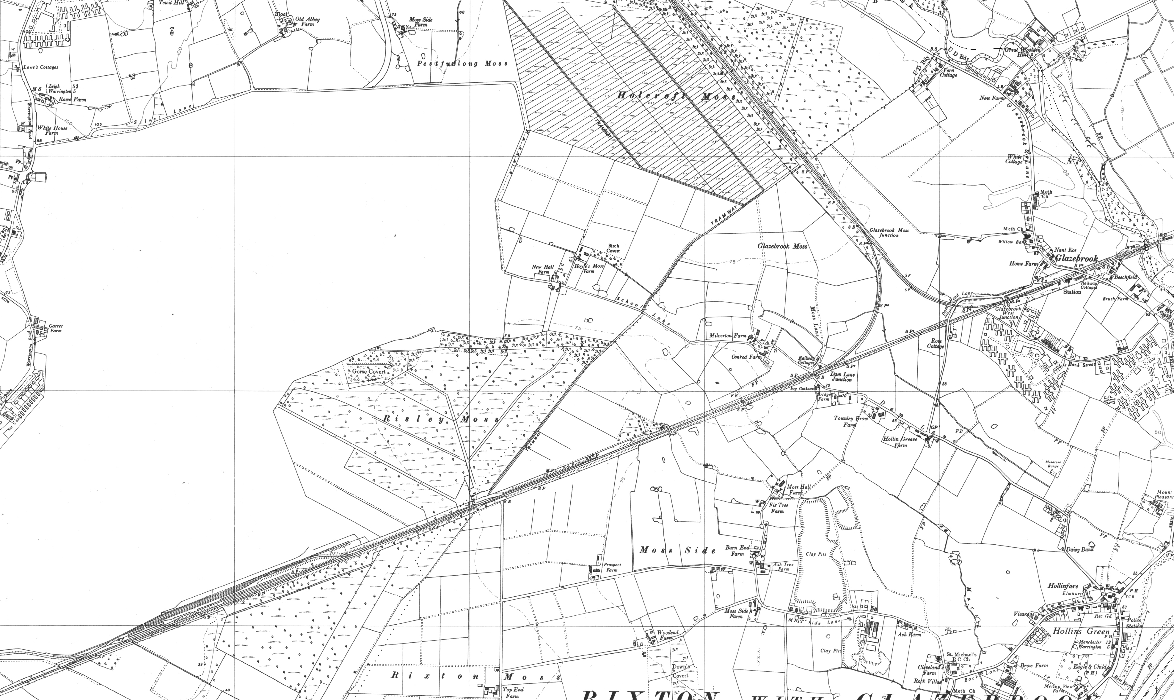
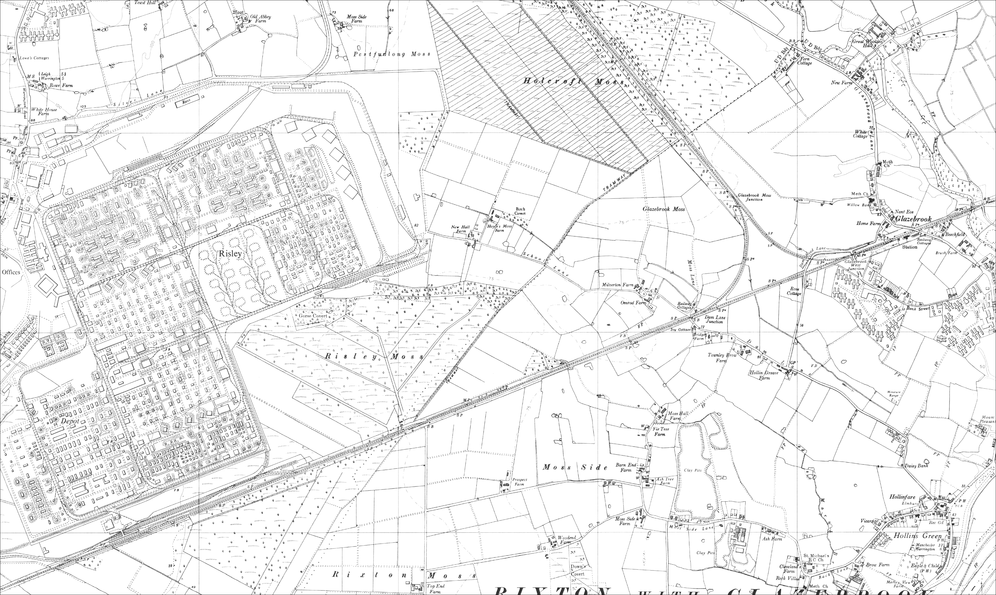
ROF Risley (WWII filling factory, and later used for atomic energy and warfare research and development) – operational 1939-1963
OS 1:10,000 scale 1958
OS 1:10,000 scale 1966
Whether through Cold War paranoia or legitimate security concerns, it was further decided in 1957 that all descriptions of factories, works, mills and collieries would be erased and replaced with generic terms, e.g, an ‘asbestos roofing works’ as noted on mapping would hereafter be referred to as a ‘works’ only. Whilst this was relaxed around 1964, descriptions were only permitted if it ‘is quite clear these are unlikely to change’ and must be only ‘in the most general terms’.
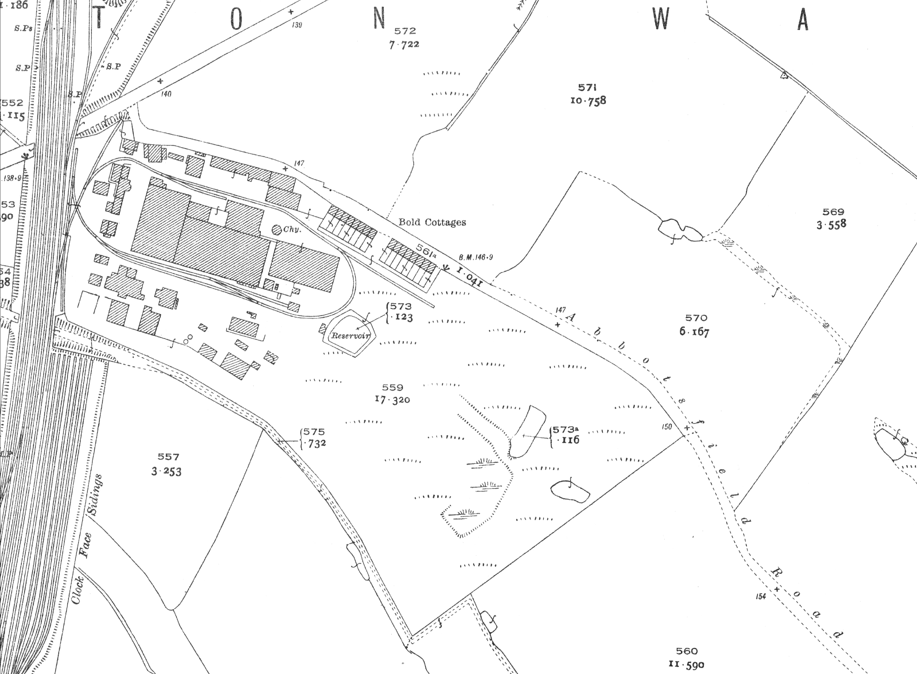
Whilst many factories used for military purposes were already (and continued) in industrial use, historical mapping will not give you the full picture of the activities undertaken there. Sutton Oak factory in St Helens was used in WWI for the manufacture of synthetic phenol and latterly for the manufacture of chemical warfare agents including sarin gas, mustard gas and many experimental chemical agents until its closure in 1957.
Sutton Oak, St Helens – operational between 1915-1957
OS 1:2,500 scale map 1928
During both WWI and WWII, many sites in existing industrial use were requisitioned for use as ordnance factories, shell filling factories, explosives manufacture, chemical warfare manufacture and other uses to support the war effort. In most cases these wartime uses would not have been detailed on any maps and survive only as local knowledge and within National Archive records.
Groundsure have undertaken independent research to identify many of these secret sites, from Royal Ordnance Factories to chemical warfare manufactures. The database currently holds hundreds of sites covering 16,830 ha of land within England, Wales and Scotland. Future research projects will add sites on a rolling basis. These sites appear across the country, from the Chemical Weapons Research Establishment at Portreath in Cornwall to RAF Kinloss near Elgin in Morayshire.
Groundsure’s unique ordnance and military site database is now available in the Enviro Insight report as standard.
Kindly shared by Groundsure


