Property at risk from Norwich’s hidden chalk-mining legacy
Groundsure have written an article that looks into how property is at risk from Norwich’s hidden chalk-mining legacy in Norfolk.
Mining in Norfolk’s county town is suggested to date back as early as the 12th Century. However, across the county, there is clear evidence of mineral extraction dating back over 5000 years. In this latest case study examining major cities and the impacts of non-coal mineral mining, we look at how chalk has shaped the city’s streets and sculpted its many subterranean caverns.
Chalk plays a key role in agriculture and is commonly used for liming – a mix naturally high in calcium and magnesium used to help fertilise the ground and balance the pH of the soil. It was also used within the construction industry and the growing expansion of the city meant the demand was high, coupled with the expansion of farming to support the city and its surroundings. Consequently, the number of mining operations in the city multiplied rapidly.
Flint was also mined sporadically throughout the city, although less extensively than at the world famous prehistoric mines 40 miles away near Thetford Forest. Known as Grimes Graves, they include over 400 mine shafts and produced quality flint to be used as hand tools, hand axes, scrapers and microliths, a Neolithic person’s Swiss Army Knife.
Fast forward a few thousand years and the use of chalk in Norwich’s buildings is very evident just by walking the city’s streets. It is clear how important this sedimentary carbonate rock really is, as it helps make up some beautiful historic buildings throughout the city.
The earliest examples of chalk mines are very far removed from modern day methods of extraction. Initially, they are likely to have begun as chalkwell excavations, consisting of a narrow shaft sunk through the overlying ground onto the chalk bed. From this, a cluster of galleries were dug out leaving a beehive shaped excavation below ground. As miners would have been using simple tools and bare hands, these workings are normally found at shallow depths, working the chalk closest to the surface. When Chalk Mines Meet Residential Housing
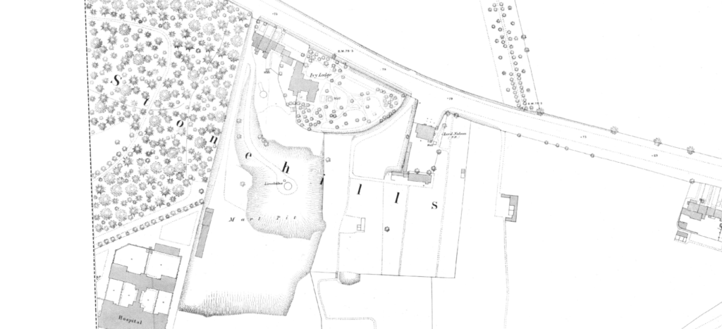
A significant cluster of recorded workings can be found around Merton Road in the city. Early Ordnance Survey mapping gives us a clue in that the area is clearly marked as “Stonehills”, but it also shows the presence of a small marl pit and associated limekiln. Over time, the quarry rapidly expanded and additional recorded lime kilns suggested an increase in production and growth of the operation. Available mining records for the area show cases of subsidence, as well as a maze of underground workings believed to possibly emanate from the faces of the recorded quarry.
Maddy Davey, Search Writer for Groundsure’s Mining Consultancy Team, says:
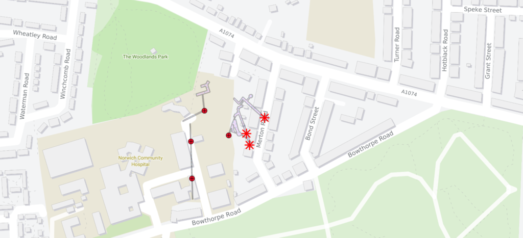
“The area around Merton Road has had multiple subsidence events related to historical chalk mining recorded in the past century.
“Tragically, one sinkhole event in 1936 swallowed an entire house including two residents who were asleep upstairs. A second house was also damaged beyond repair. Engineers reported high groundwater levels had weakened the roof of the old underground chalk mining features causing it to collapse.
When sinkholes or subsidence events occur, it gives us an opportunity to investigate previously unrecorded or even unknown underground mining features.
“Groundsure has amassed considerable records of these mining features, although due to the style of historical mining it is inevitable there are still unknown features so knowledge of the area is key.
“When the underground mines in Norwich closed, many of the tunnels and caverns fulfilled other purposes, such as those beneath St Leonard’s Hill and Earlham Road which morphed into wine stores and were subsequently used as air raid shelters.
“These transformations really fuel the imagination, making searches in these areas interesting work.”
Historical Mapping & Intelligent Mining Data Work Hand-in-Hand

Historical map image of the Stonehills area of Norwich…

…and how the shafts and collapses impacted on the modern city layout
How many more developments on top of these workings have taken place without prior due diligence? With increased climate change, more soluble soil and rocks like chalk and limestone may be more prone to collapse as both locally heavy rainfall or drought-related subsidence from clays and gravels could accelerate the risk.
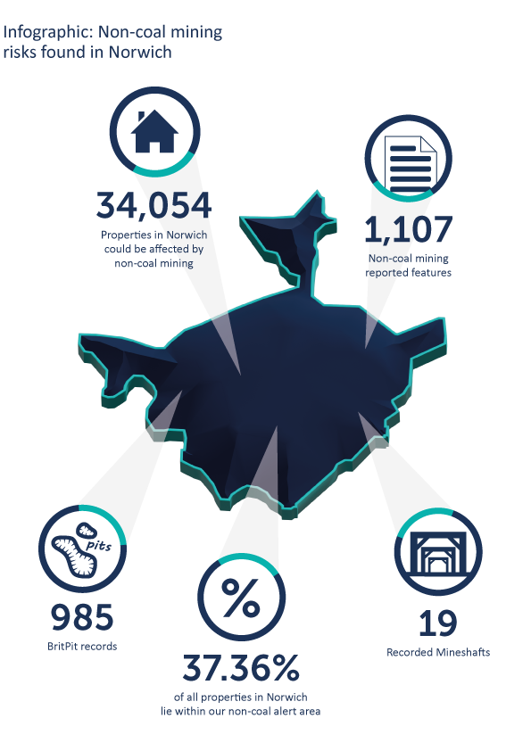
Our recent white paper has revealed the potential scale of this risk. In excess of 34,000 properties, covering 37% of the City of Norwich area could be affected by future subsidence from past non-coal mining activity.
When assessing historic mining activity we have a comprehensive understanding of mineral extraction throughout the UK, with our mining consultants constantly expanding their regional knowledge and expertise. We bring a superior level of knowledge gained from over 40 years of in-depth research and investigations enabling us to obtain a fuller appreciation of what lies beneath the surface.
To protect your client as part of their conveyancing searches, order an Avista report from Groundsure. Not only do you get ten environmental searches including contaminated land, flooding and natural ground stability, but mining of ALL types including coal AND non-coal minerals like the chalk found in Norwich. Not only that, you can access our expert mining consultancy team on your client’s specific site, property or development opportunity to see how it could be impacted, or indeed if the risk can be mitigated.
For more information about Avista contact us on 01273 277 755, or email us at [email protected].
References
https://www.bournemouth.ac.uk/research/projects/neolithic-flint-mines
https://www.eveningnews24.co.uk/news/local-council/tom-jones-norwich-sinkholes-8239224
Kindly shared by Groundsure
Main photo courtesy of Pixabay


